Scientists examine coral loss in 240-year old nautical maps
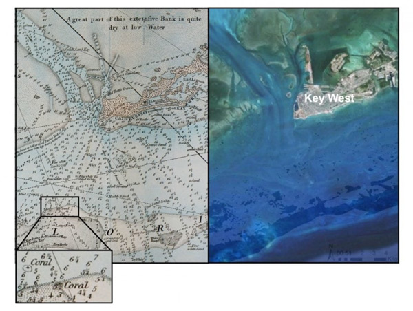
In a study recently published in the journal Science Advances, scientists compared nautical charts between 1773 and 1775 of the Florida Keys to satellite data. Specifically, the nautical charts recorded exact location of corals. The location of existing present day coral match the nautical maps. However, over half of the coral recorded in the nautical charts is missing today.
This is what Loren McClenachan, a marine ecologist at Colby College in Maine, had to say about the study:
“With the early charts you can actually see the reef itself being drawn. It matches almost exactly with the satellite data.”
Read the full article here.