Using AIS and satellite data to track illegal fishing vessels
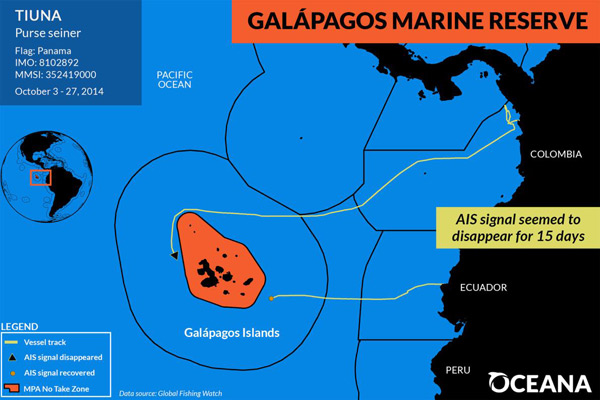
Conservationists are using algorithms and satellite data to help combat illegal fishing on the high seas and in marine protected areas. Environmentalists from Oceana have published data acquired from four separate case studies showing how illegal fisherman turn off their AIS (Automated Identification System) when entering marine protected waters and then turn it back after exiting. Often times these locations are home to highly lucrative fish, including tuna, sharks, and other protected fisheries.
Read the full article here.